Scenic Drives in Kenya
May 8, 2026
Kenya Safari Travel Distances
May 8, 2026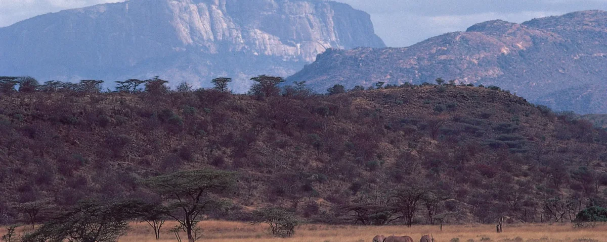
Kenya Map and Regions
Kenya Map and Regions: Kenya stands as one of Africa’s most powerful safari destinations, offering diverse landscapes, rich wildlife, and world-class travel experiences. From the sweeping plains of the Maasai Mara to the snow-capped peaks of Mount Kenya, every region delivers a unique adventure. Travelers from around the world choose Kenya because it blends classic safari moments with cultural depth and breathtaking geography.
This guide explores the Kenya safari map in a practical and insightful way, helping travelers understand how each region connects and what makes each area special. Instead of random travel planning, this structured breakdown helps you visualize Kenya as a complete safari circuit. As a result, you can design smarter routes, reduce travel time, and maximize wildlife encounters.
Kenya’s safari regions do not operate in isolation. They form an interconnected system of ecosystems, migration routes, and cultural landscapes. Therefore, understanding the map gives you a strategic advantage when planning a safari. Whether you want big cat sightings, elephant herds, birdwatching, or coastal relaxation, Kenya offers it all in one destination.
Understanding the Kenya Safari Map
The Kenya safari map divides the country into distinct regions, each offering unique wildlife and scenery. Generally, the main safari zones include the southern circuit, central highlands, northern frontier, Rift Valley lakes, and coastal belt. These regions connect through road networks and airstrips, making travel flexible for different budgets and schedules.
The southern circuit includes famous parks like Maasai Mara, Amboseli, and Tsavo. These areas attract most safari travelers because of high wildlife density and iconic landscapes. The central highlands feature Mount Kenya and the Aberdare ranges, offering forest safaris and mountain ecosystems. Meanwhile, the northern frontier introduces rugged terrain and cultural experiences with pastoral communities.
The Rift Valley region stretches across the country and includes lakes such as Nakuru and Naivasha, known for flamingos and birdlife. Finally, the coastal region adds a tropical twist with marine parks and beach safaris. Understanding this layout helps travelers choose routes that match time, budget, and interests while avoiding unnecessary backtracking across long distances.
Maasai Mara National Reserve Region
The Maasai Mara region sits in southwestern Kenya and forms the heart of classic African safari experiences. It connects directly with Tanzania’s Serengeti ecosystem, making it a key location for the Great Migration. Every year, millions of wildebeests, zebras, and gazelles cross these plains in search of fresh grazing land. This natural event creates one of the most dramatic wildlife spectacles on Earth.
The landscape in Maasai Mara features open savannah, rolling grasslands, and scattered acacia trees. This environment supports a dense population of predators, including lions, cheetahs, and leopards. As a result, visitors often witness intense predator-prey interactions in real time. Game drives here deliver high success rates for wildlife sightings, even on short stays.
In addition to wildlife, the region also offers rich cultural experiences with the Maasai people. Their traditions, homesteads, and storytelling add depth to the safari experience. Because of its accessibility and wildlife concentration, Maasai Mara remains a top priority in any Kenya safari map planning.
Amboseli and Southern Circuit
The southern circuit of Kenya features Amboseli National Park and surrounding conservancies. This region sits near the border of Tanzania and offers some of the most iconic views in Africa. Mount Kilimanjaro rises in the background, creating dramatic photography opportunities, especially during sunrise and sunset.
Amboseli is famous for large elephant herds that move freely across open plains. These elephants often appear against the backdrop of snow-capped Kilimanjaro, creating one of the most recognizable safari images in the world. The park also hosts lions, hyenas, giraffes, and diverse bird species.
Beyond Amboseli, the southern circuit includes private conservancies that focus on sustainable tourism. These areas provide quieter safari experiences with fewer vehicles and more personalized game drives. Therefore, travelers who prefer exclusivity often choose this region. The southern circuit connects well with Nairobi, making it a practical starting point for longer Kenya safari routes.
Tsavo East and Tsavo West National Parks
Tsavo East and West form one of the largest protected wildlife ecosystems in Kenya. Located between Nairobi and Mombasa, this region covers vast wilderness areas that support a wide range of animals. Tsavo East features open plains and red-dust elephants, while Tsavo West offers volcanic landscapes, springs, and rocky hills.
Because of its size, Tsavo delivers a more remote safari experience compared to other parks. Wildlife here spreads across large distances, so visitors enjoy a sense of true wilderness. Common sightings include elephants, lions, buffalo, giraffes, and hippos. Birdlife also thrives in the wetlands and river systems.
Tsavo West adds unique attractions like Mzima Springs, where clear waters allow underwater viewing of hippos and crocodiles. This contrast between dry savannah and lush water sources makes the region especially diverse. For travelers moving between Nairobi and the coast, Tsavo acts as a strategic safari stop along the Kenya map.
Kenya Map and Regions: Samburu and Northern Frontier Region
The northern frontier region, including Samburu National Reserve, offers a different safari experience compared to southern Kenya. The landscape becomes drier, more rugged, and less crowded. However, this environment supports unique wildlife species that do not appear in other parts of the country.
Samburu is known for the “special five” animals: Grevy’s zebra, Somali ostrich, reticulated giraffe, gerenuk, and Beisa oryx. These species adapt to arid conditions and create a distinct wildlife viewing experience. The Ewaso Ng’iro River also attracts animals, especially during dry seasons.
Cultural interactions play a major role in this region. The Samburu people maintain traditional lifestyles that reflect deep connections to the land. Visitors often combine game drives with cultural visits, creating a richer understanding of northern Kenya. Because the region sits farther from Nairobi, it feels more exclusive and untouched, appealing to experienced safari travelers.
Kenya Map and Regions: Lake Nakuru and Central Rift Valley
The central Rift Valley hosts Lake Nakuru National Park, one of Kenya’s most famous birding destinations. The lake attracts large flocks of flamingos, although numbers vary depending on water levels and algae conditions. Even beyond flamingos, the park supports rhinos, lions, leopards, and buffalos.
The landscape around Lake Nakuru includes wooded areas, rocky cliffs, and open grasslands. This mix of habitats creates strong biodiversity within a relatively small park. As a result, visitors often see multiple species in a single game drive. The park also serves as a strong conservation zone for both black and white rhinos.
The Rift Valley itself stretches across Kenya and forms part of the country’s geological backbone. Travelers often combine Lake Nakuru with Lake Naivasha for boat safaris and birdwatching. This region fits perfectly into shorter safari itineraries due to its proximity to Nairobi and smooth road access.
Kenya Map and Regions: Aberdare Range and Mount Kenya Region
The central highlands of Kenya include the Aberdare Range and Mount Kenya region. This area differs from typical savannah safaris because it features forests, waterfalls, and alpine landscapes. Wildlife here adapts to cooler climates and dense vegetation.
Aberdare National Park offers unique safari lodges where animals visit waterholes at night. Visitors often spot elephants, buffalos, and rare species like the bongo antelope. The forest environment creates a quiet, mysterious safari atmosphere that contrasts with open plains.
Mount Kenya, Africa’s second-highest peak, dominates the skyline and offers trekking opportunities for adventure travelers. The surrounding ecosystem supports rich biodiversity and scenic beauty. This region also plays a key role in Kenya’s water system, feeding rivers and supporting agriculture. As part of the safari map, the highlands provide balance between wildlife viewing and nature exploration.
Kenya Map and Regions: Kenyan Coast Safari and Marine Parks
Kenya’s coastal region adds a tropical dimension to safari travel. After exploring wildlife parks, many travelers continue to Mombasa, Diani, or Watamu for beach relaxation. However, the coast also offers marine parks and underwater ecosystems that expand the safari experience beyond land.
Watamu Marine National Park and Kisite-Mpunguti Marine Park protect coral reefs, dolphins, and sea turtles. Snorkeling and diving activities allow visitors to explore vibrant marine life. This creates a unique combination of safari and ocean adventure within one country.
The coastal culture also enhances the travel experience. Swahili traditions, historic towns like Lamu, and coastal cuisine provide cultural depth. Because of its location, the coast connects easily with Tsavo and inland safari circuits. Therefore, many travelers design itineraries that end with beach relaxation after wildlife exploration.
Kenya Map and Regions: Nairobi National Park and Urban Safari Access
Nairobi National Park offers one of the most unique safari experiences in the world. Located just outside Kenya’s capital city, it allows travelers to see wildlife with a city skyline in the background. Lions, rhinos, giraffes, and zebras roam freely within the park boundaries.
This proximity makes it an ideal starting point for safari journeys. Travelers arriving in Kenya can experience wildlife within hours of landing. The park also supports conservation education and serves as a reminder of the balance between urban growth and nature protection.
Despite its small size compared to other parks, Nairobi National Park delivers high wildlife visibility. It also connects easily to other safari regions through road and air networks. Therefore, it plays a key role in the overall Kenya safari map by providing quick access to authentic wildlife experiences.
Kenya Map and Regions: Best Time to Explore Kenya Safari Regions
Timing plays a major role when exploring Kenya’s safari regions. Generally, the dry seasons from June to October and January to February offer the best wildlife viewing conditions. During these months, animals gather around water sources, making sightings easier and more predictable.
The Maasai Mara becomes especially active between July and September during the Great Migration. This period attracts global travelers and creates peak safari demand. Meanwhile, birdwatching improves during wet seasons when migratory species arrive in large numbers.
Each region responds differently to seasonal changes. For example, coastal areas remain warm year-round, while highland regions stay cooler. Therefore, understanding seasonal patterns helps travelers choose the right destinations at the right time. Smart planning ensures better wildlife experiences and smoother travel across the Kenya safari map.
How to Plan Safari Routes Using the Map
Planning safari routes in Kenya requires a strategic approach. The first step involves identifying key interests such as big cats, elephants, birdlife, or cultural experiences. After that, travelers can group nearby destinations to reduce travel time and costs.
A common route includes Nairobi, Amboseli, Maasai Mara, and Lake Nakuru. This circuit covers diverse ecosystems within a manageable distance. Alternatively, travelers can combine Tsavo with the coast for a wildlife-to-beach journey. Air travel also helps connect distant regions like Samburu or the northern frontier.
Using the Kenya safari map effectively allows travelers to avoid unnecessary backtracking. It also improves overall travel efficiency while maximizing game viewing opportunities. Giant Holiday Safaris, as a trusted tour operator, provides expert guidance in route planning, ensuring travelers enjoy seamless journeys and well-balanced itineraries.
With proper planning and regional understanding, every safari in Kenya becomes more immersive, balanced, and rewarding, especially when supported by the expertise of Giant Holiday Safaris.
Conclusion
Kenya offers one of the most complete safari experiences in Africa, and understanding its map unlocks deeper travel value. Each region contributes a unique layer, from the wildlife-rich plains of Maasai Mara to the coastal beauty of the Indian Ocean. Together, they form a powerful network of ecosystems that support diverse adventures.
By studying the Kenya safari map, travelers gain clarity, confidence, and control over their itineraries. This knowledge reduces stress while enhancing experiences. Giant Holiday Safaris, as a trusted tour operator, helps travelers maximize this value by providing expert guidance, tailored itineraries, and seamless planning.
With smart planning and regional insight, every safari in Kenya becomes a story of discovery, connection, and lasting memory, especially when supported by the expertise of Giant Holiday Safaris.
Combined Uganda, Kenya, Rwanda and Tanzania Safaris
17-day Kenya, Tanzania, and Uganda safari
19-Day Uganda, Kenya, and Tanzania Safari
16-Day Kenya, Tanzania, and Uganda Safari
14-Day Kenya, Uganda, and Tanzania Safari
14-Day Kenya, Uganda, and Rwanda Safari
12 Day Gorilla Trekking and Tanzania Safari
A 20-day East African safari